
Bestand:Spice Islands (Tanzania).svg

Afmetingen van deze voorvertoning van het type PNG van dit SVG-bestand: 486 × 599 pixels Andere resoluties: 195 × 240 pixels | 389 × 480 pixels | 623 × 768 pixels | 831 × 1.024 pixels | 1.661 × 2.048 pixels | 713 × 879 pixels.
Oorspronkelijk bestand (SVG-bestand, nominaal 713 × 879 pixels, bestandsgrootte: 15 kB)
Beschrijving
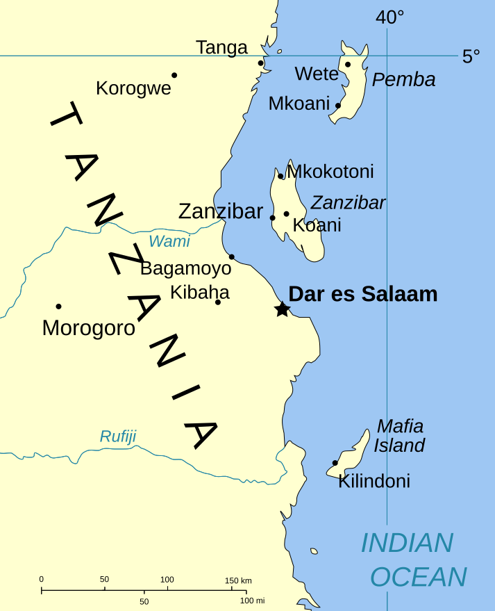
| Beschrijving | Part of the map of Tanzania, showing the Spice Islands. |
| Datum | |
| Bron | Vectors self-made in Inkscape. Source was cropped from http://www.lib.utexas.edu/maps/africa/tanzania_pol_2003.jpg which is said to be in the public domain in the Perry-Castañeda Map Collection FAQ. |
| Auteur | Mysid |
| Toestemming (Hergebruik van dit bestand) |
PD |
| Andere versies |
Image:Spice Islands (Zanzibar highlighted).svg in French : Image:Spice_Islands_Tanzania-fr.svg in French : Image:Spice_Islands-Zanzibar_highlighted-fr.svg |
Licentie
| Ik, de auteursrechthebbende van dit werk, geef dit werk vrij in het publieke domein. Dit is wereldwijd van toepassing. In sommige landen is dit wettelijk niet mogelijk; in die gevallen geldt: Ik sta iedereen toe dit werk voor eender welk doel te gebruiken, zonder enige voorwaarden, tenzij zulke voorwaarden door de wet worden voorgeschreven. |
Bestandsgeschiedenis
Klik op een datum/tijd om het bestand te zien zoals het destijds was.
| Datum/tijd | Miniatuur | Afmetingen | Gebruiker | Opmerking | |
|---|---|---|---|---|---|
| huidige versie | 6 jan 2007 22:01 | | 713 × 879 (15 kB) | Mysid | (a bit more) standard colors |
| 29 mei 2006 08:44 |  | 713 × 879 (20 kB) | Mysid | corrected buggy scale | |
| 29 mei 2006 08:40 |  | 713 × 879 (20 kB) | Mysid | New version, exported from CorelDraw (inkscape seems buggy) | |
| 28 mei 2006 20:23 |  | 713 × 893 (37 kB) | Mysid | {{Information |Description=Part of the map of Tanzania, showing the Spice Islands. |Source=Vectors self-made in Inkscape. Source was cropped from http://www.lib.utexas.edu/maps/africa/tanzania_pol_2003.jpg which is said to be in the pu |
Bestandsgebruik
Dit bestand wordt op de volgende pagina gebruikt:
Globaal bestandsgebruik
De volgende andere wiki's gebruiken dit bestand:
- Gebruikt op ckb.wikipedia.org
- Gebruikt op da.wikipedia.org
- Gebruikt op eo.wikipedia.org
- Gebruikt op eu.wikipedia.org
- Gebruikt op fa.wikipedia.org
- Gebruikt op fo.wikipedia.org
- Gebruikt op fr.wikipedia.org
- Gebruikt op hr.wikipedia.org
- Gebruikt op it.wikipedia.org
- Gebruikt op ja.wikipedia.org
- Gebruikt op mi.wikipedia.org
- Gebruikt op no.wikipedia.org
- Gebruikt op pt.wikipedia.org
- Gebruikt op sr.wikipedia.org
- Gebruikt op sv.wikipedia.org
- Gebruikt op vi.wikipedia.org
- Gebruikt op zh.wikipedia.org


.svg)
.svg)